-
Welcome to this forum . We are a worldwide group with a common interest in Birmingham and its history. While here, please follow a few simple rules. We ask that you respect other members, thank those who have helped you and please keep your contributions on-topic with the thread.
We do hope you enjoy your visit. BHF Admin Team
You are using an out of date browser. It may not display this or other websites correctly.
You should upgrade or use an alternative browser.
You should upgrade or use an alternative browser.
Warwick Road Acocks Green
- Thread starter redken
- Start date
S
Stitcher
Guest
This picture is looking towards Solihull and is just before the Kineton Green Road R oad and Warwick Road junction.
oad and Warwick Road junction.
S
Stitcher
Guest
And here is a more up to date pic of the same spot.

S
Stitcher
Guest

Another one of The Dolphin, Olton is behind the camera.
devonjim
master brummie
See #1 above for a 1950's shot of above!Due to the pandemic, the West Way car showroom on the Warwick Road in Tyseley has sadly closed down. They used to sell Nissan cars and vans there.

devonjim
master brummie
If you look at #11 above and zoom in you will see how the site has changed over the years from 1970.How long ago was that church demolished. And when it was replaced with that car showroom?
.png")
Another of the junction as in #64 and #65. It’s labelled the ‘old’ and ‘new’ Warwick Road.

Thanks
A couple of Warwick Road at Acocks Green


At Tyseley

Thanks
A couple of Warwick Road at Acocks Green
At Tyseley
Someone may be able to pinpoint more precisely this image of Warwick Road - labelled as Birmingham. Viv.

Radiorails
master brummie
I can only guess it as at the juction of Startfod Road and Warwick Road as there are tqwo sets of overhead wires visible. One for Hall Green (right) and Warwick Road (left). It would seem we are looking at the commencement of Warwick Road presumably before the Mermaid was built maybe.
Last edited:
.png")
devonjim
master brummie
Having lived at various times in and around Acock's Green familiar with these views, but unsure of the location of the "Garage" view, perhaps junction of Warwick Rd and Station Rd. Can anyone confirm. The Tyseley one is junction of Knights Rd and Warwick Rd. I even remember the railway fence on the right.Another of the junction as in #64 and #65. It’s labelled the ‘old’ and ‘new’ Warwick Road.
View attachment 147371
Thanks
A couple of Warwick Road at Acocks Green
View attachment 147372
View attachment 147373
At Tyseley
View attachment 147375
ellbrown
ell brown on Flickr
Yeah #74 is the Stratford Road junction with Warwick Road in Sparkhill. Except that corner turret tower has long gone. Now a Portuguese restaurant called Farro's. It was closed for the best part of a decade due to two fires, when before it was The President Restaurant. Also the William Bloye Mermaid sculpture has disappeared.
farmerdave
master brummie
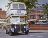
Another message to confirm the location of #74 being at the junction of Warwick Road and Stratford Road near the Mermaid. In this photo from the book "Birmingham Buses: route by route 1925-1975" by Malcolm Keeley, we see a number 37 bus about to continue along the Stratford Road (southbound) from the Mermaid island, while a lorry marked "timber" is about to leave the Warwick Road and join the Stratford Road. The photograph was taken in 1963. The shops with the elaborate brickwork, on the right-hand side of the photo, are identical to those on the left-side of #74. One of the shops is marked "H.E. Turner and Son" (above the red lorry), and was primarily a fishmonger but may have also sold fruit. Horace and Peter Turner ran that shop for many, many years. There are some markings on the shop window in #74 (left-hand side) but I cannot quite make them out. The shop seems to have a white-tile lower frontage and perhaps could have been a fishmongers. Looked on Google View and noted that some of the shops with the distinctive markings are still there today but the bay windows seem to have gone. Dave.
Attachments
devonjim
master brummie
I was wrong about the "Garage" view, in fact 180 degrees out. Corner to left Shirley Rd. The building centre rear is the old "New Inns" which was somewhere near what is now Barclay's Bank, on the corner of Westley Rd. Thanks to J.V.Tustin 1953 history.Having lived at various times in and around Acock's Green familiar with these views, but unsure of the location of the "Garage" view, perhaps junction of Warwick Rd and Station Rd. Can anyone confirm. The Tyseley one is junction of Knights Rd and Warwick Rd. I even remember the railway fence on the right.
https://aghs.jimdofree.com/acocks-green-c-1903

David Greet
Brummie babby
I attended St Bedes Church on Warwick Road in the late 1950s. On a Sunday morning I used to ring the bell (see the arch at the peak of the front) for the 11am service, then 3pm Sunday School and the evening service which I think was at 6:30pm (I couldn't sing, but was in the choir for a while). It was a part of St John's Church at Sparkhill with the Rev Jackson in charge but normally run by a Miss Stanley and Rev Griffiths. Mr Knight, who was the postmaster at Greet post office was also a lay preacher. There was a hall at the rear which was used as a youth club in the late 50s.Yes, that’s the one. Thank you.
From the latest Google Earth pictures it looks to be still used by a religious group.
Oldgreetboy2
proper brummie kid
I used to play the pinball machine in that cafe, they did a great sausage sandwich.Just a little further past Mountford Street and before Percy Road was another newsagents shop Haddow's next door to Dot's Café.
View attachment 119540
Oldgreetboy2
proper brummie kid
Hi Theresa, I went to Sunday school in the hall at the back.I can only remember one building facing the road but a hall at the back of the property.


Cliff gebhard
proper brummie kid
There definitely wasI'm almost certain there was a Greenway's fishing tackle shop at Kinstanding too - corner of Hawthorn Road and Warren Farm Road. Viv.
RobT
Acemeccanoman
Thank you pjmburns, it is an area I am very familiar with, but not in that period of time.1915 Kelly's - bank in right place and next door but one to cycle manufacturer
View attachment 162574
Your help very much appreciated, as always.
")