-
Welcome to this forum . We are a worldwide group with a common interest in Birmingham and its history. While here, please follow a few simple rules. We ask that you respect other members, thank those who have helped you and please keep your contributions on-topic with the thread.
We do hope you enjoy your visit. BHF Admin Team -
HI folks the server that hosts the site completely died including the Hdd's and backups.
Luckily i create an offsite backup once a week! this has now been restored so we have lost a few days posts.
im still fixing things at the moment so bear with me and im still working on all images 90% are fine the others im working on now
we are now using a backup solution
You are using an out of date browser. It may not display this or other websites correctly.
You should upgrade or use an alternative browser.
You should upgrade or use an alternative browser.
Speedy23
master brummie
That was the point.......none of them are there any more.....I am sure you know that they don't exist any more.
Haven has a nursing home on the site. Valley has flats
Bagnall has a McDonald's
Not sure about the Warstock but think it is flats.
Janet Hunt
master brummie
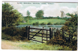
Apparently it was called Priory windmill and was in Solihull lodge area on Windmill Farm, Priory Lane. Was demolished in around 1957.Where? When? I'm very interested....
Solihull Lodge Windmill
Demolished in 1957 http://www.macearchive.org/Archive/T...
 slwyw.blogspot.com
Attachments
Radiorails
master brummie
There is a lot about the windmill, either earlier in this thread,
https://birminghamhistory.co.uk/for...ill-wind-mill-lane-yardley.49938/#post-643379 .
It is also known as Colebrrok Priory Mill by other earlier names.
I was familiar with this mill when I lived in the area - prior to 1954.
https://birminghamhistory.co.uk/for...ill-wind-mill-lane-yardley.49938/#post-643379 .
It is also known as Colebrrok Priory Mill by other earlier names.
I was familiar with this mill when I lived in the area - prior to 1954.
Pedrocut
Master Barmmie
Windmills of Birmingham and the Black Country by McKenna, Joseph.
“Cooper's mill was situated in Heath Mill Lane, Deritend. It is shown on Samuel and Nathaniel Buck's South-West
Prospect of Birmingham, published in 1731. The Cooper family also worked the nearby water mill, shown on William Westley's East Prospect of Birmingham. In a view of 1779, Cooper's windmill is shown as a smock mill a point confirmed in Thomas Dixon's view of 1826, where the mill is shown with common sails.
Development of the area about this time ensured the mill's demise. It’s last miller was Thomas Whitmore, who held Cooper's mill from 1825 to 1836.
Pedrocut
Master Barmmie
Reproducing the picture posted by Dennis in Post 432 …Samuel Lines, from dome of St Philips.
Spot the Windmill.

“Birmingham Heath Mill was built on the common land to the north of the town. There by 1814, the windmill is shown in a painting by Samuel Lines as a squat, white-painted structure, in his view from St. Philip's cupola. It lay some distance back from the Dudley Road, approached by a fordrough, opposite to where Heath Street North now is. Joseph Flecknoe was recorded as miller in 1830. A smock-mill, it ended its working life in 1849 when the land was secured by the Guardians of the Poor for the erection of a new Workhouse.”
Spot the Windmill.
“Birmingham Heath Mill was built on the common land to the north of the town. There by 1814, the windmill is shown in a painting by Samuel Lines as a squat, white-painted structure, in his view from St. Philip's cupola. It lay some distance back from the Dudley Road, approached by a fordrough, opposite to where Heath Street North now is. Joseph Flecknoe was recorded as miller in 1830. A smock-mill, it ended its working life in 1849 when the land was secured by the Guardians of the Poor for the erection of a new Workhouse.”
Windmills of Birmingham and the Black Country, by McKenna, Joseph.
Pedrocut
Master Barmmie
Also from the above book, Hutton’s Mill…
“East now to the Birchfield Road. On the edge of the Aston Hall Estate, was Hutton's mill, built in 1759 for the Birmingham historian William Hutton. He used it in an unsuccessful attempt to produce paper cheaply. Cheated by his work-men, or so he believed, he resolved on 30th June 1761 that he was determined to make no morepaper at the mill but dispose of It if he could, if not convert it to another use. He eventually sold it to Rebecca Honeyborn in 1763.
A bottle-kiln shaped tower mill, it was eventually converted into dwelling houses and became known as Birchfield Round House. Hutton's windmill was demolished at the end of the 19th Century. Further along the Birchfield Road, just off the present Livingstone Road, was Bristnalls End mill. The mill had disappeared by the time Samuel Botham undertook his survey, but he recorded field number BJ320 as Windmill Piece'. This field and its neighbour, Berry's Croft, were offered for sale in 1813.
Pedrocut
Master Barmmie
Bleak Hills Mill…
Bleak Hills mill was situated just east of Witton Upper Pools. It was built sometime after 1760, as it is not shown on the Erdington Estate map of that year. Certainly it was in operation by 1814, and in 1830 being worked by a Miller called Oldacre. Elizabeth Oldacre, possible his widow, was in possession in 1834, though the mill was owned by the Handworth landowner Wyrley Birch. The mill had ceased operation by the end of the 19th Century.”
Bleak Hills mill was situated just east of Witton Upper Pools. It was built sometime after 1760, as it is not shown on the Erdington Estate map of that year. Certainly it was in operation by 1814, and in 1830 being worked by a Miller called Oldacre. Elizabeth Oldacre, possible his widow, was in possession in 1834, though the mill was owned by the Handworth landowner Wyrley Birch. The mill had ceased operation by the end of the 19th Century.”
Pedrocut
Master Barmmie
Maney Hill Mill.
Sutton Coldfield, Birmingham's newest suburb, borders onto the old parish of Aston. The oldest recorded of Birmingham's windmills was situated here at Maney Hill. The mill is referred to in a document of 1309, wherein it is recited that, none of these customary tenants used to grind his corn but at the lord's water-mill, so long as the mill was in repair for grinding, unless they first paid the whole of the corn to the lord's miller, upon pain of forfeiture of the whole corn; excepting the tenants of Maney, Windley and Wigula, who ground at the lord's windmill at Maney."
Probably the first of several windmills on this site, one of the four pier stones on which one of the later mills rested was discovered in the early 1850s: a large stone was turned out of a hedge-row on the hill; it measured about five feet in length and two feet in width and thickness and was of a fine grained, hard, dark, substance, apparently limestone or trap; but it was unfortunately broken up for the roads before its nature could be ascertained.
Windmills of Birmingham and the Black Country by McKenna, Joseph.
Pedrocut
Master Barmmie
Langley Mill and High Heath Mill.
There were two other windmills at Sutton, Langley Mill and High Heath Mill. Langley windmill was probably run in conjunction with the nearby watermill. Possibly of 17th Century origin or earlier, this windmill is not shown on any of the
early 18th Century maps, and was most certainly gone by 1722. The site is clearly marked as Windmill Field on the Ordnance Survey 2 inch to 1 mile drawing of 1811, and confirmed as such on the 1 inch to 1 mile map of 1834.
High Heath Mill was situated just under two miles east-north-east of Sutton Coldfield town centre, between the Tamworth and Withy Hill Roads. Built by 1725, this postmill is shown on both Beighton's map of 1750, and Jeffery's map of 1755. It was demolished though by 1788 when James Sheriff was surveying for his map of 25 miles round the Town of Birmingham.
Pedrocut
Master Barmmie
Wake Green Mill…
Further south, where Hall Green forms the parish boundary with nearby Moseley, was Wake Green Mill. A postmill, situated on a small knoll in what is now the playing fields lying just off Yardley Wood Road before its junction with Swanshurst Lane. The mill is referred to in a deed of 166426 when it was in the possession of Richard Grevis. The deed relates to "all that windmill with the appurtenances situate and being near unto the said Watermills (at Greethurst and Swanshurst)". In 1766 John Allen leased the mill, then in the possession of John Taylor, for 14 years at an annual rent of £18. He was still in possession in 1773 as is shown by an indenture of that year which refers to "All that windmill with its Appurts situate near a place called Moseley Wake Green ... standing upon part of the, common or beaste land belonging to and being parcel of the Manor of Yardley.
David Cox, the Birmingham artist, immortalised the mill in a sketch of 1819. Sometime between that date and 1834 the mill was demolished.
Pedrocut
Master Barmmie
Lyndon Green Mill, Wells Green Mill, Sheldon Mill.
To the east of Yardley village lay the parish of Sheldon. Of its three mills, two were probably Medieval. The oldest appears to be Lyndon Green mill. It is not shown on any of the early 18th Century maps, but its site, now bounded by Elmay, Benedon and Larne Roads, is recorded in the Sheldon Tithe of 1840 as Windmill Close. Wells Green Mill was situated north east of the Green. It is depicted as a Demolished very early in the 18th Century, its site is marked as Old Mill Hill on both Beighton's map of 1725 and Jeffery's of 1755. Sheldon windmill, just off the Bresent Rectory Park Road, was apparently built to replace it. In existence by 1788, on or very close to the site of the old Wells Green windmill, it is shown as a postmill. In the Sheldon Tithe of 1840, the mill is owned by Richard Greenway, and being worked by John Greenway. Interestingly two fields in close proximity are each known as "Windmill Close," and may mark the site of the earlier Wells Green windmill.
To the east of Yardley village lay the parish of Sheldon. Of its three mills, two were probably Medieval. The oldest appears to be Lyndon Green mill. It is not shown on any of the early 18th Century maps, but its site, now bounded by Elmay, Benedon and Larne Roads, is recorded in the Sheldon Tithe of 1840 as Windmill Close. Wells Green Mill was situated north east of the Green. It is depicted as a Demolished very early in the 18th Century, its site is marked as Old Mill Hill on both Beighton's map of 1725 and Jeffery's of 1755. Sheldon windmill, just off the Bresent Rectory Park Road, was apparently built to replace it. In existence by 1788, on or very close to the site of the old Wells Green windmill, it is shown as a postmill. In the Sheldon Tithe of 1840, the mill is owned by Richard Greenway, and being worked by John Greenway. Interestingly two fields in close proximity are each known as "Windmill Close," and may mark the site of the earlier Wells Green windmill.
Pedrocut
Master Barmmie
Edgbaston Mill.
In Edgbaston, noted more for its watermills than its windmills, there was one, run in conjunction with a much older watermill. In 1810 John Heeley was paying rates for two Speewell mills. The windmill is shown on a map of 1814. and on Greenwood's Map of Warwickshire for 1822, where it appears to be known as Edgbaston Mill. Members of the Stratford-upon-Avon family of Lucy were millers here in the late 1820s and early 1830s. The mill is not shown on the Ordnance Survey Map of 1834, and was presumably no longer in existence.
In Edgbaston, noted more for its watermills than its windmills, there was one, run in conjunction with a much older watermill. In 1810 John Heeley was paying rates for two Speewell mills. The windmill is shown on a map of 1814. and on Greenwood's Map of Warwickshire for 1822, where it appears to be known as Edgbaston Mill. Members of the Stratford-upon-Avon family of Lucy were millers here in the late 1820s and early 1830s. The mill is not shown on the Ordnance Survey Map of 1834, and was presumably no longer in existence.
Pedrocut
Master Barmmie
Ridgacre Mill.
The last known of Birmingham's windmills was in the parish of Ouinton. Ridgacre mill was situated in the circle of roads that now make up Hagley, Clydesdale and Ridgacre Roads, and Stoney Lane. The site is recorded in the Ridgacre Tithe of 1844 as "Windmill Piece" and on the 25 inches to 1 mile Ordnance Survey Map of 1883 there is, a little way to the east, Windmill Farm. Most probably a postmill, it is not shown on any of the 18th Century maps and appears to have been demolished before 1722.
The last known of Birmingham's windmills was in the parish of Ouinton. Ridgacre mill was situated in the circle of roads that now make up Hagley, Clydesdale and Ridgacre Roads, and Stoney Lane. The site is recorded in the Ridgacre Tithe of 1844 as "Windmill Piece" and on the 25 inches to 1 mile Ordnance Survey Map of 1883 there is, a little way to the east, Windmill Farm. Most probably a postmill, it is not shown on any of the 18th Century maps and appears to have been demolished before 1722.
Below is a supposed map of the Edgbaston mills from Terry Slater's book" Edgbaston. A History". He states that it was sued for grinding corn till the 1880s , then made into a farmhouse, but demolished recently. Also a photo of it as a farmhouse.Edgbaston Mill.
In Edgbaston, noted more for its watermills than its windmills, there was one, run in conjunction with a much older watermill. In 1810 John Heeley was paying rates for two Speewell mills. The windmill is shown on a map of 1814. and on Greenwood's Map of Warwickshire for 1822, where it appears to be known as Edgbaston Mill. Members of the Stratford-upon-Avon family of Lucy were millers here in the late 1820s and early 1830s. The mill is not shown on the Ordnance Survey Map of 1834, and was presumably no longer in existence.


Here is a photo of it in 1898, when it had presumably only recently ceased being a mill

Pedrocut
Master Barmmie
Smethwick Mill.
Smethwick Windmill was situated in a yard near the corner of Ballot Street and Windmill Lane, opposite the Windmill Inn. The land whereon it stood was purchased in February 1803 by William Croxall, a miller, from John Reynolds for £37.
A 50 feet high brick tower mill with 3 pairs of stones, the mill ceased working in 1873. Edward Cheshire bought the site with its mill for his brewery, and the mill featured prominently in its advertising. The Brewery itself adopted the name
"Windmill Brewery". Sadly though the mill was only used as a storehouse for barley. Late in its life Smethwick Windmill was used as a bicycle park and finally a Civil Defence lookout. In August 1949 the mill was examined and found to be structurally unsafe. It was demolished, but in the process the iron boss at the, end of the main windshaft which held the sails, was shown to bear the date 1707. It seems probable that Croxall incorporated the remains of some earlier mill into his windmill at Smethwick. The sails, as well as a portion of the mechanism which had been removed some years
previous, are now exhibited in the Science Museum in South Kensington.
pjmburns
master brummie
I live opposite there and there is much debate about exactly where the mill was.Wake Green Mill…
Further south, where Hall Green forms the parish boundary with nearby Moseley, was Wake Green Mill. A postmill, situated on a small knoll in what is now the playing fields lying just off Yardley Wood Road before its junction with Swanshurst Lane. The mill is referred to in a deed of 166426 when it was in the possession of Richard Grevis. The deed relates to "all that windmill with the appurtenances situate and being near unto the said Watermills (at Greethurst and Swanshurst)". In 1766 John Allen leased the mill, then in the possession of John Taylor, for 14 years at an annual rent of £18. He was still in possession in 1773 as is shown by an indenture of that year which refers to "All that windmill with its Appurts situate near a place called Moseley Wake Green ... standing upon part of the, common or beaste land belonging to and being parcel of the Manor of Yardley.
David Cox, the Birmingham artist, immortalised the mill in a sketch of 1819. Sometime between that date and 1834 the mill was demolished.