• Welcome to this forum . We are a worldwide group with a common interest in Birmingham and its history. While here, please follow a few simple rules. We ask that you respect other members, thank those who have helped you and please keep your contributions on-topic with the thread.

    We do hope you enjoy your visit. BHF Admin Team

Bristol Road

Shortie

master brummie
One for Mike here, please, if you can.

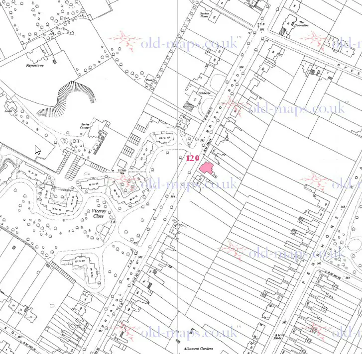
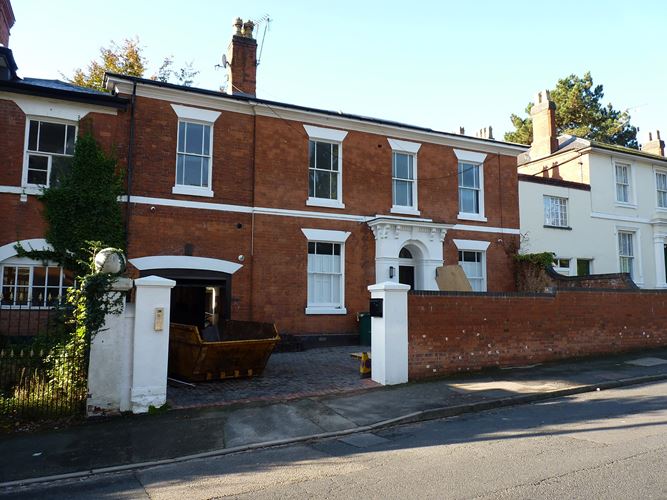
I am looking for the whereabouts of No 120 Bristol Road. I have a 1913 map, I can find a house called 'The Corinthians' but I am unclear as to the number. 120 was the home of a Birmingham Architect and Builder, Thomas Naden, whose daughter Constance was a famous poet in her time. We suspect the house has gone but there is a chance it may still be there.
 
Below is a map c 1950. numbering had not changed since 1913. Nos 116 and 122 are shown on the map, so red marked house must be 120
Road off to the right from Pershore road is Edward Road, with the corner of Calthorpe park just above it

map_c_1950_showing_120_Bristol_road.jpg
 
Thank you mike, but it's left me a little confused. 'The Corinthians' was and still is No 96, so I was working it out to be further down the road, however, I do realise it's possible for some building that I considered to be houses may have been just extra buildings for the adjacent house. Thank you very much for this, Mike, at least we know what we are looking for.

Shortie
 
Thanks Mike, I have done that. I know the road very well, and so does Leslam who lives nearby, and using the 1913 Alan Godfrey map,we both got the same house further down the road. It looks like some buildings may have changed before 1950, or at least been demolished, looking the 1950's map. We knew it had got to be a large house, as on the 1911 it was split into two, 120 had eleven rooms, 120a had eight. Some job, the dusting in that house!
 
Shortie, if you count down from the one we know is 96, the one that Mike has coloured is the one we identified after you posted the original query, I think. Mikes map is just a different one to the one we used. To help others with this sort of thing, if you use the National Library for Scotland overlay system, it's possible to overlay an old map onto a modern map. In our case, this shows that two new cul-de-sacs and new houses fronting onto Bristol Road were constructed by knocking down numbers 100 to 134.
The old house at 98 is there and so are 136 onwards. Unfortunately, the one we were looking for were sacrificed :(
 
Last edited:
Back
Top