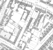
Hi, I'm trying to place 45 Witton Street and I'm hoping someone can help.
On the 1881 census it is listed as next door to "Prices Cottages", but I can't find this on even detailed maps of Witton Street from the time. It's also apparently near to Court 8, but of course that doesn't tell you whether it was next door or opposite.
I'm 95% certain it was on the side of the road that became Garrison Lane Park, so it would have been demolished in 1910.
Many thanks.