DavidGrain
master brummie
I recently went to a talk about the Regents Canal. Apparently the worst place for graffiti is under the HQ of British Transport Police. The BTP do not have jurisdiction on the canals.
Morturn
I think the building you refer to on Carolina's photograph was originally part of the old brewery behind the Crown pub , possibly originally the malthouse. In the 1960s I think that part had been converted into a cold storage facility

We had come up the Grand Union and then taken the canal with 5/6 locks that joins the GU to the Birmingham and Fazeley. It was late, the locks were hard, stiff, all the paddles needed attention, we went through the stop lock at the junction, the bow hit the wall on your photo, the stern hit the canal bank on the port side (left hand) and we were jammed, it took 20 minutes to forward and revers, use the boat hook and pole and feet to get it free, by the time we were starting to head to Fazeley all thoughts of a good pub meal were put away, we tied up by the main road bridge by Jaguar, found the KFC........and then slept like logs. Even the early morning shift who used the canal towpath did not wake us. We had a maximum length boat, the advice we got from experienced hands afterwards was helpful but too late.
I feel I know it but can you put my son in law and myself with a location pleaseCanals have small changes over the years but the surroundings can have large changes.
A Keith Berry Photo from 1986
View attachment 110540
A Keith Berry Photo from 1990 some improvements near the locks.
View attachment 110541
The same place today.
View attachment 110542
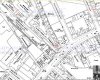
Thank you it looked like the scene of our unfortunate experience, but that of course was further downHi Bob, the location is in Deykin Avenue circled on this iPad screen shot.
oldmohawk
View attachment 110547
It looks like the photo of a canal burst seen in another forum post ... click link below
https://birminghamhistory.co.uk/for...everyone-wore-a-hat.41994/page-12#post-560786

View attachment 110751
I have a little difficulty with the description given in the Sphere, someone please put me right!
"The water poured down Lionel Street, and a great volume swept along Newhall Street..."
Now at the point that Lionel Street intersects with Newhall Street is a high point


Ellbrown, we were in Regent's Park. On that little arm of the canal (at least I think it's am arm). Your heron looks a lot less forbidding than ours did, sitting immobile in the branches and on the banks, all with hunched shoulders and steely glares. They're odd looking birds on a good day.
Hi Speedy23 ... Lovely photo, I would have a guess at it being somewhere on the Worcester & Birmingham canal in southwest Birmingham or even further out.And getting back to Brum, can anyone identify where this is and what canal we are looking at?
View attachment 110982
PS - the lady is my Mom - I think the photo was taken in the early 1950's - before I was even thought of!
I've walked this canal from Worcester to Alvechurch and don't recognise this scene but it could be just North of Wharf Road in Kings Norton there are playing fields on the left and the houses in Baldwin Road are the correct style for the houses on the right, but only a guess!Thanks for replying, oldMohawk........Near.....ish....not a million miles away - definintely within the City limits, though!
Cheers
When I see the question 'Where is this' on the BHF I get tempted to have a go.And getting back to Brum, can anyone identify where this is and what canal we are looking at?
View attachment 110982
PS - the lady is my Mom - I think the photo was taken in the early 1950's - before I was even thought of!


.jpg")